

A Customized Assessment: The Case of the Lac-Saint-Jean-Est RCM Climate Plan

Greening communities, conserving natural habitats, improving stormwater management… Nature-based solutions are increasingly being incorporated into climate change adaptation strategies because they help build the resilience of communities while providing a wide range of environmental and social benefits.
But, among this wide range of measures, which ones will enable communities to achieve tangible results that will help protect their quality of life and their environment in the long term? To identify the most promising actions, regional county municipalities (RCMs) must first assess the climate risks and vulnerabilities specific to their territory. The Lac-Saint-Jean-Est MRC’s Climate Plan is a good example of this approach.
As early as the summer of 2024, the Lac-Saint-Jean-Est RCM was one of the first RCMs to launch a Climate Plan initiative as part of the Accelerating the Local Climate Transition (ATCL) program. Launched by the Ministry of the Environment, Climate Change, Wildlife, and Parks (MELCCFP), this program aims to better equip municipalities and MRCs to mitigate and adapt to a changing climate.
The Power of a Customized Climate Plan
In order to tailor the Climate Plan to the specific characteristics of each region, as well as to the MRC’s concerns and priorities, Habitat has developed a robust methodology based on international standards. This methodology takes into account the likelihood of hazards, the severity of their consequences, and the region’s vulnerability to these climate impacts.
💡 In environmental planning, a hazard refers to a natural event of climatic origin that may cause harm to people, property, or ecosystems, such as torrential rain, a heat wave, or a flood.
These variables are then incorporated into the following formula:
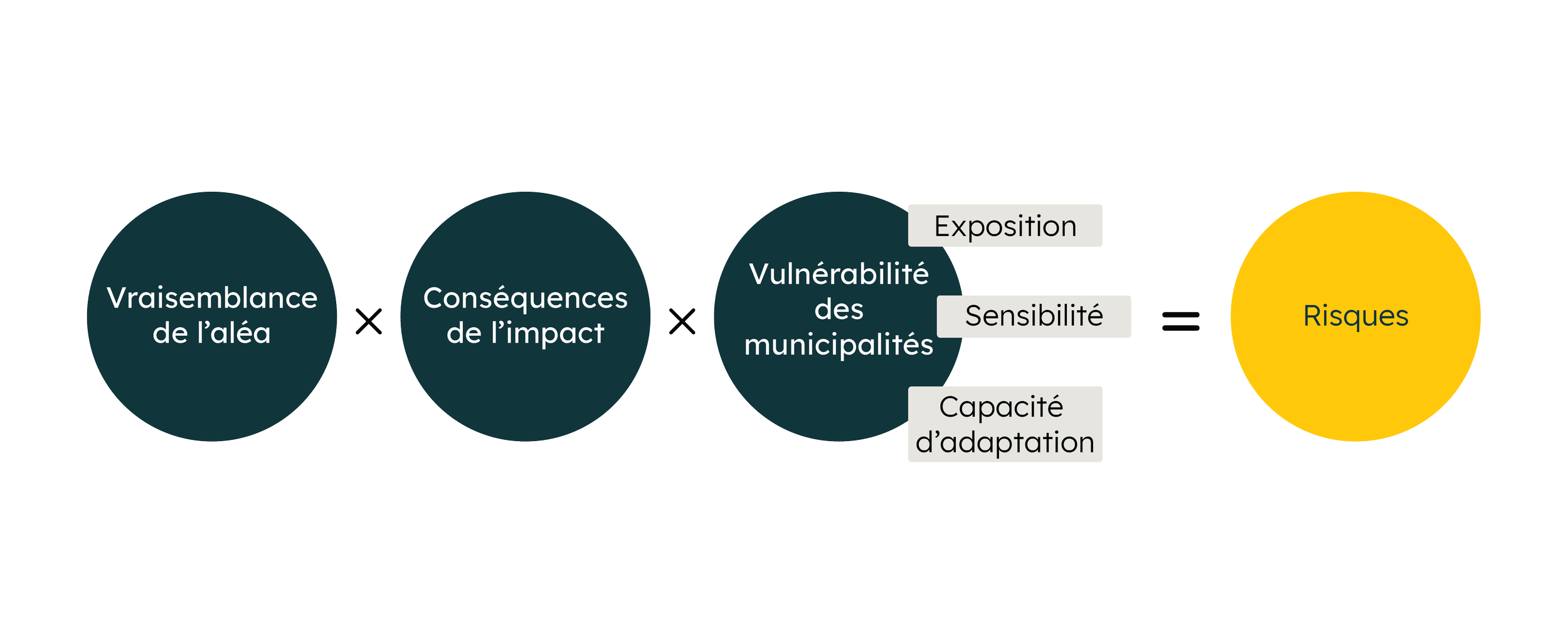
The vulnerability analysis proposed by Habitat goes beyond ministerial requirements. It serves as a complementary measure to risk assessment and plays a central role in tailoring the action plan. However, even before factoring this into the equation, the development of a climate assessment must go through several stages.
First, translating land-use planning requirements into concrete actions requires not only access to high-quality data, but also the ability to translate that data into relevant assessments. It is not enough to simply inform land-use planners about the projected increase in liquid precipitation in the Lac-Saint-Jean-Est RCM under moderate or high greenhouse gas (GHG) emission scenarios. It is also necessary to explain how these changes might manifest themselves in the daily lives of communities.
How will this climate-related hazard affect the water system, flood risks, or soil stability? How severe will these impacts be? Are certain municipalities more vulnerable based on the specific characteristics of their natural environment, their capacity to adapt, or their demographic profile?
Mapping climate risks using mapping tools makes it possible to visually synthesize these various elements in order to support the prioritization of adaptation measures.
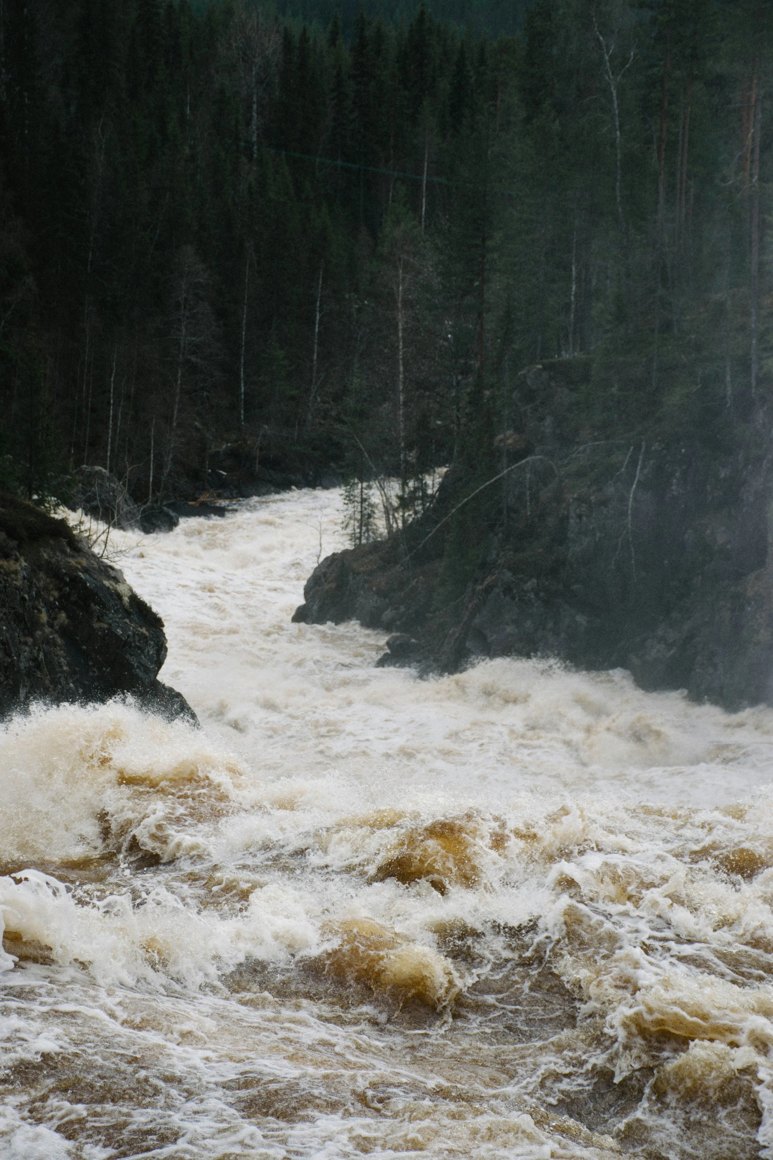
For example, increased rainfall—due to the greater amount of water absorbed by the soil—can trigger landslides in certain types of soil. Landslides can cause damage to road and water management infrastructure, with significant repercussions for municipal services, public health and safety, and the condition of waterways.
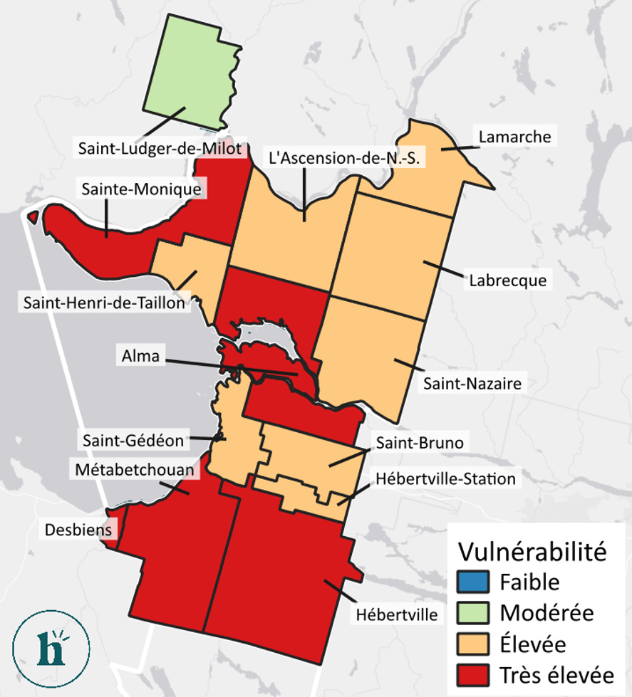
Generally, municipalities located near landslide-prone areas will be the most vulnerable to landslides. To mitigate the consequences, the landslide-prone area map below can help determine where to focus adaptation efforts.
In practical terms, Alma’s very high vulnerability could indicate a need to undertake soil stabilization or infrastructure reinforcement projects in at-risk areas.
An approach rooted in local realities
Developing a climate action plan tailored to the region also requires close collaboration with the MRC, its member municipalities, and various local stakeholders. These stakeholders provide in-depth knowledge of the region’s vulnerabilities, challenges, and resources, which makes it possible to design realistic measures aligned with local realities.
For the Lac-Saint-Jean-Est RCM, Habitat established a committee of local experts in early 2026 to ensure that the findings of the process are well aligned with the realities of the RCM, both in terms of the territory and the local stakeholders.
A public consultation, in which Habitat also participated, helped shed light on citizens' concerns and explain the main findings of the risk assessment in layman's terms.

When the Climate Plan Comes to Life
Supported by the Ministry of Municipal Affairs and Housing (MAMH), Phase 2 of the ATCL program helps MRCs turn their adaptation goals into concrete achievements.
Since a climate plan is only as effective as the foundation on which it is built, it is essential to rely on a rigorous methodology grounded in local realities in order to effectively guide a regional county municipality’s future actions and investments.
In the Lac-Saint-Jean-Est RCM, the assessment conducted by Habitat helped inform the revision of flood zones and the design of resilient infrastructure for stormwater management.
