Reinventing urban forest management: tree inventory by remote sensing and selection of climate-adapted species

A step forward for urban forestry
Cities are facing growing challenges linked to climate change, biodiversity loss and the sustainable management of their green spaces. In this context, having an accurate and complete picture of the urban forest is essential to effectively plan arboricultural interventions and strengthen the resilience of living environments.
An innovative solution from Habitat
Habitat offers an important technological advance: a remote sensing tree inventory method that includes not only trees on public rights-of-way, but also those on private land, often invisible from the public space.
This approach is based on a combination of geospatial data and machine learning algorithms. By analyzing satellite images and extrapolating public data, Habitat is able to estimate the forest composition of a territory, including species identification, height, crown width and diameter at breast height of each tree.
A method designed for municipalities
This approach is particularly well-suited to the municipal context, since many cities have more trees in private than public rights-of-way, and these private trees often contain more diverse species than municipal trees. By integrating these data, Habitat enables municipalities to design more comprehensive urban forestry plans, based on cutting-edge science already implemented in several Quebec cities.
Planning for tomorrow's climate
In addition, Habitat has developed a tool for selecting climate-adapted trees. By cross-referencing inventory data with climate scenarios, this tool predicts the growth and vulnerability of trees according to their species and their ability to adapt to future conditions. Cities can thus orient their plantations towards more resilient species, while anticipating management and replacement costs. For example, if an area is made up of mature trees likely to suffer increased climatic stress, the municipality can adjust its investments to maintain or increase its canopy cover.
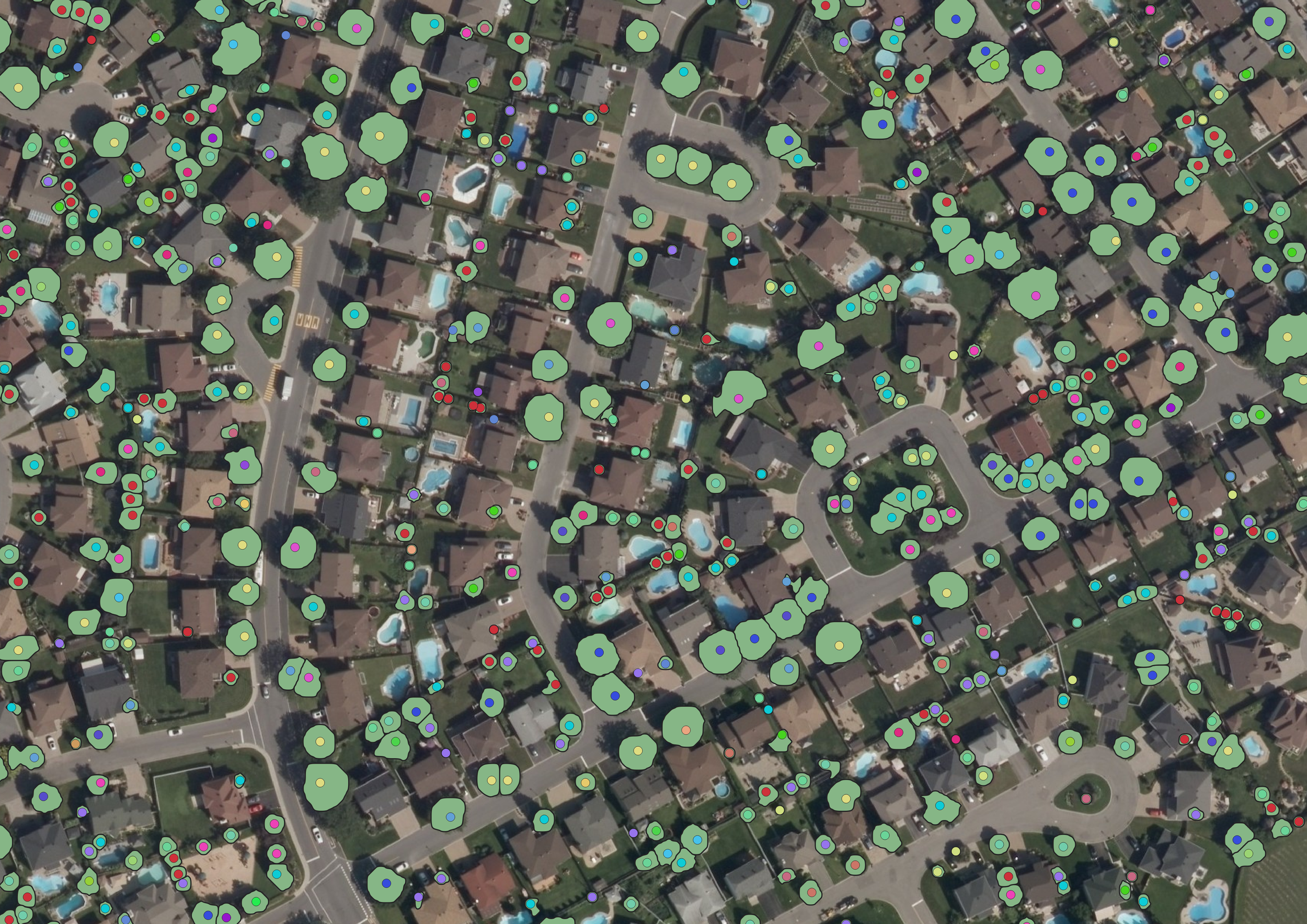
The urban canopy is shown in green, and the different colored dots represent the diversity of species in the area.
Take action for a more resilient urban forest
Thanks to its remote sensing and climate modeling tools, Habitat offers cities a comprehensive vision of their urban forest. This approach not only provides a better understanding of natural environments and tree species, but also enables them to plan their future with rigor and ecological sensitivity.