Forest agricultural corridors to promote ecosystem services
In agricultural environments, biodiversity can provide numerous benefits, such as reducing pollution, flooding and erosion. In this context, the Demain la forêt - infrastructures vertesproject, launched by Jour de la Terre and supported by the Quebec government, aims to plant trees in uncultivated agricultural areas where the slopes are too steep for cultivation (known as "coulées agricoles") throughout Quebec's agricultural territory. Earth Day has appointed Habitat as the scientific partner for this project.
Implementing nature-based solutions in these environments, such as afforestation and restoration, helps to limit erosion and the export of nitrogen and phosphorus to watercourses, promote biodiversity and mitigate the establishment of invasive exotic species, as well as contributing to climate change adaptation by storing carbon.
The first major step in this project is to identify the location of agricultural corridors throughout Quebec and prioritize certain corridors for planting according to a set of criteria presented below.
Pour l’identification, les coulées agricoles sont des zones en friche non linéaire, située en milieu agricole, ayant une pente de plus de 15% et une superficie de végétation basse (< 3m) d’au moins 0.15 hectares.
For the prioritization, Habitat first excluded all corridors overlapping with occurrences of threatened or vulnerable field species to avoid disturbing their habitat. We also excluded corridors where tall vegetation (> 3m) occupied more than 70% of the corridor, as these were already heavily forested. The remaining agricultural coulees were prioritized according to the following criteria: role in the connectivity of 5 forest wildlife species, presence of threatened or vulnerable forest species, probability of occupancy of field bird species, presence of topographic features favourable to field birds, area of coulee in low vegetation, core area (unaffected by edge effect), shape index (defined as whether the coulee is compact or not), distance to a watercourse.
Take a look at the agricultural corridors on our interactive map!
In a previous previous mandate with Environment and Climate Change Canada (ECCC), our team had already identified coulees in the central and eastern sections of the St. Lawrence Lowlands. Habitat is using the same methodology to spatialize agricultural coulees across the whole of Quebec.
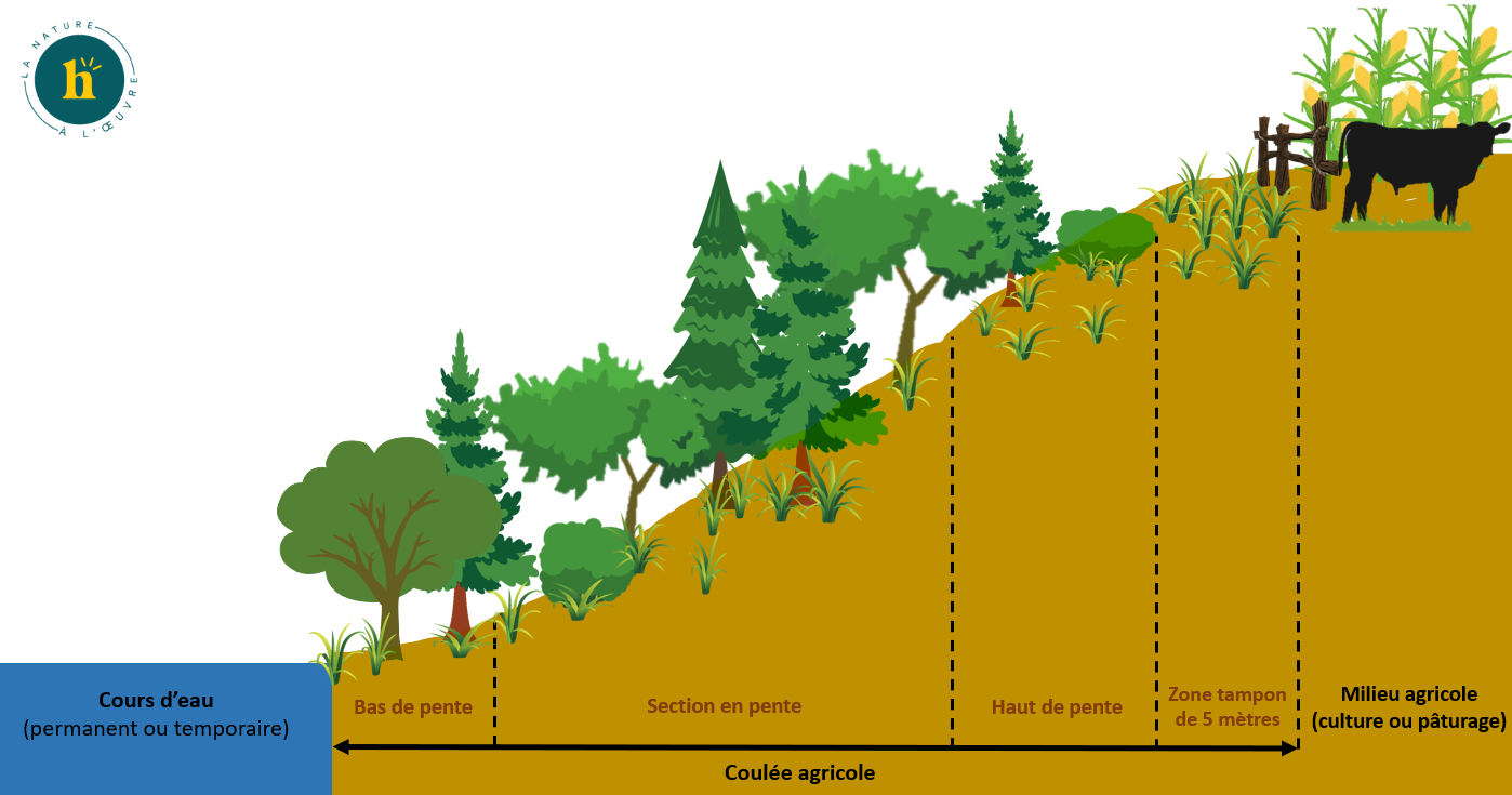
To maximize the ecological benefits of afforestation and restoration of agricultural corridors, our team recommends planting :
a herbaceous strip 4 to 6 m wide at the top of the coulee to limit the impact of tree roots on the agricultural zone
a mix of deciduous and coniferous trees in the sloping section to stabilize the slope and limit erosion
wetland-tolerant shrubs at the bottom of the slope to create a riparian buffer strip at least 3 m wide
Over the next few months, our team will be assessing the value of the benefits associated with afforestation of agricultural coulees, in particular for the following ecosystem services: carbon sequestration, pollination, flood control, etc.
Are you a farm owner who would like to take part in our agricultural corridor enhancement project? It's free, all-inclusive and beneficial for biodiversity and adaptation to climate change!
PARTNERS
PROJECT LED BY

IN COLLABORATION WITH